Please Note: Printable maps are in PDF format.
Map file sizes range from 0.1 to 1.3 mb depending upon detail level.
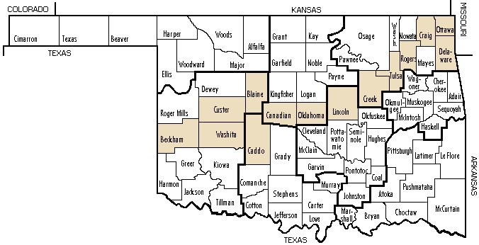
Select a county from the text list or click on a shaded county in the state map to open the associated county map. This will open a county page with selectable townships. The Historic page, with a control map, will show the various (if any) Route 66 alignment areas which will be indicated by blue, green or red alignment. Highlighted areas in orange denote sites of historic value that will associate to maps from the publication 'Oklahoma Route 66' by the author 'Jim Ross, Ghost Town Express, 2001'. Please note: These maps are copyrighted and not for commercial use.
Township maps will have the current alignment (red), original alignment (blue) and intermediate alignment (green) outlined as necessary with sites of interest, if applicable. Site pages will have details of the historic site.
Route 66 Resources which have been determined eligible for inclusion in the National Register of Historic Places (NRHP). Identified by numbers (ie: Site 22) used in 2002 Oklahoma Route 66 Roadbed Documentation Project undertaken by the Oklahoma State Historic Preservation Office. When applicable, sites will be listed in the historic section of the associated county.

|
County Selectable State Map

|
|
|


