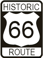
Java Scrip Must Be Enabled to view pictures and highway history.
HOME >  Central Office >  Planning & Research >  Route 66 >  Picture Gallery Contact Planning & Research

Oklahoma's Memorial Highways & Bridges

Route 66

Dedication & Legislation

Route 66 Introduction

Route 66 Background

Construction History

Route 66 Maps

Route 66 Picture Gallery
• Clicking on thumbnail pictures in the gallery will create a new window that may be printed •


New maps are searchable using Acrobat Reader Version 6

Get Adobe Acrobat logo button


Back Gallery Home


Picture Gallery  - Route 66

Across Oklahoma


Horse Drawn Road Grader

Motor powered Motorgrader

Motorgrader
       Signing for accident prevention
Signing for accident prevention
       Signing at US66 and FM4

Signing at US66 and FM4


SAP 654C Bridge over Horse Branch
SAP 654C Bridge
       SAP 654C Bridge over Bitter Creek
SAP 654C Bridge
       Section of Highway Westbound US66
Westbound US66


NRM 149B East of Vinita in Craig County
       NRH 164I Overpass

NRH 164I Overpass
       Section of Highway Along US66
Section of Highway Along US66


View of Automatic Traffic Recorder
Automatic Traffic Recorder
Looking West
       View of Automatic Traffic Recorder
Automatic Traffic Recorder
Looking South Across Road


Lexington Bridge

Lexington Bridge
       Lexington Bridge in black and white
Lexington Bridge
in black and white


Back Gallery Home


Maps

• Memorial Bridges
  PDF 133kb

• Memorial Highways
  PDF 205kb


HOME >  Central Office >  Planning & Research >  Route 66 >  Picture Gallery  BACK TO TOP