Java Script needed to open printable window views.
HOME >  Central Office >  Planning & Research >  Construction History of Route 66 >  Gallery Contact Planning & Research

A Chronology of the Construction History of Route 66 in Oklahoma

Cover

Acknowledgements

Forward

Introduction

Construction History

Picture Gallery
• Clicking on thumbnail pictures in the gallery will create a new window that may be printed •


New maps are searchable using Acrobat Reader Version 6

Get Adobe Acrobat logo button


Project FAP 8
Project FAP 8


Site 1 Kansas State Line North of Quapaw
Intersection at Site 1 Kansas State Line North of Quapaw

Site 1 Kansas State Line North of Quapaw


Site 1 Kansas State Line North of Quapaw
Ditch at Site 1 Kansas State Line North of Quapaw


Site 2 Ottawa Co. Sec.9, T29N, R24E facing south, North end of 1926-32 alignment

Site 2 Ottawa Co. Sec.9, T29N, R24E facing south, North end of 1926-32 alignment


Site 3 EW4 Co. Rd. Sec.35, T29N, R23E, West end of 1926-32 alignment


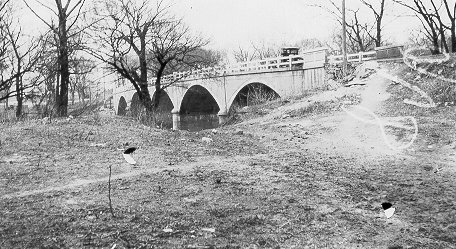
Site 4 Bridge built in 1939, 1933 alignment Sec.3, T28N, R23E


Site 5 Tar Creek, built 1933, Reconstructed 1956, east of Commerce on US69 facing east
Site 5 Side View of Tar Creek, built 1933, Reconstructed 1956, east of Commerce on US69 facing east


Site 5 Tar Creek, built 1933, Reconstructed 1956, east of Commerce on US69 facing east
Site 5 Roadway View of Tar Creek, built 1933, Reconstructed 1956, east of Commerce on US69 facing east


Site 6 FAP105A built 1924 on Main Street in Commerce 1926-52 alignment, improved on west side only in 1956


Site 7 Main and Commerce Streets in Commerce, facing east, 1926-32 alignment


Site 8 Coleman Theatre on 1st SW and N. Main Streets in Miami on NW corner, Route 66 until July 1968


Site 9 Miami on Main Street south of 1st facing east on west side


Site 9 Miami south of 1st on Main Street facing north


Site 10 1926-37 alignment, built anew in 1967, on SH125
Site 10 View 1 1926-37 alignment, built anew in 1967, on SH125

Site 10 1926-37 alignment, built anew in 1967, on SH125
Site 10 View 2 1926-37 alignment, built anew in 1967, on SH125

Site 10 1926-37 alignment, built anew in 1967, on SH125
Site 10 View 3 1926-37 alignment, built anew in 1967, on SH125


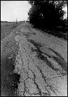
Site 11 9 foot wide paved highway Sec.7, T27N, R22E south of Miami 1926-37 alignment
Site 11 - 9 foot wide paved highway Sec.7, T27N, R22E south of Miami 1926-37 alignment


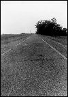
Site 12 9 foot wide paved highway Sec.7, T27N, R22E south of Miami 1926-37 alignment
Site 12 - 9 foot wide paved highway Sec.7, T27N, R22E south of Miami 1926-37 alignment


Site 13  9 foot wide paved highway Sec.7, T27N, R22E south of Miami 1926-37 alignment
Site 13 - 9 foot wide paved highway Sec.7, T27N, R22E south of Miami 1926-37 alignment


HOME >  Central Office >  Planning & Research >  Construction History of Route 66 >  Gallery BACK TO TOP