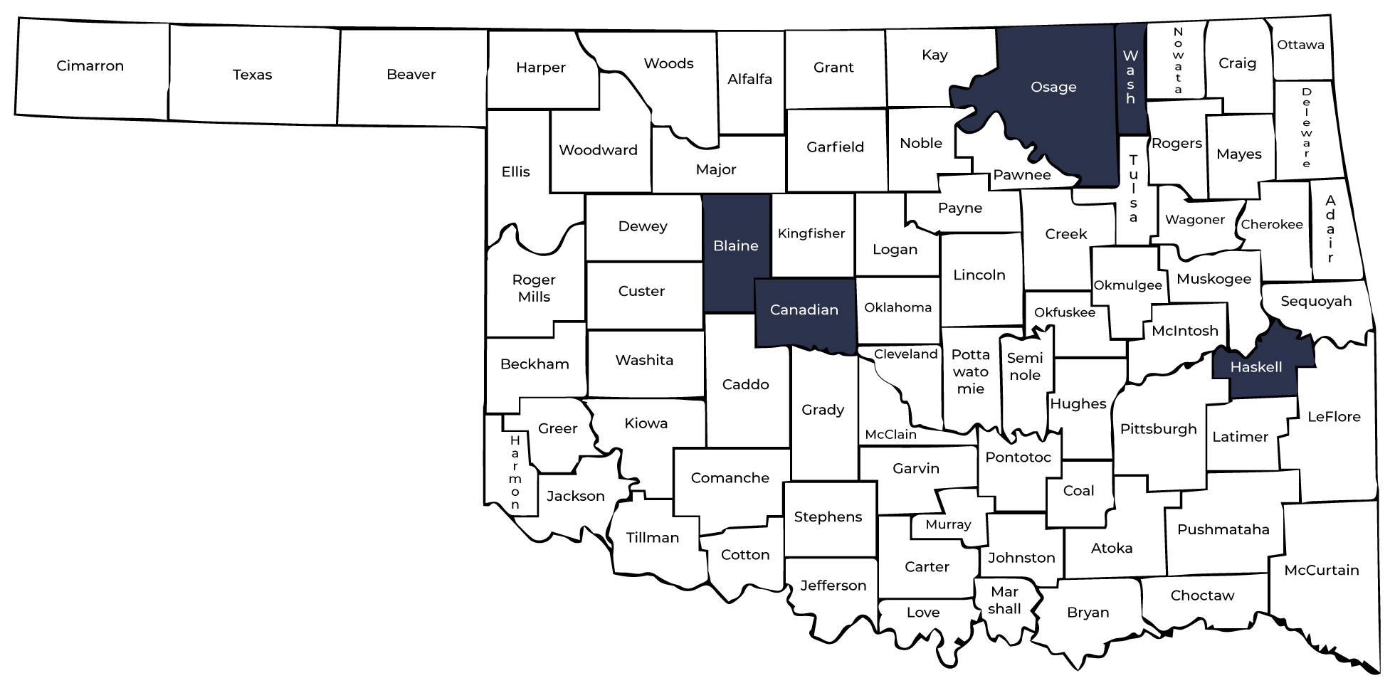
Counties With Bridges Posted 15 Tons or Less Are Shaded


NOTICE
Listed Bridges are for Counties with Bridges Posted 15 Tons or Less on State Highways, US Highways and Interstates Only ( Shaded Counties on State Map above )
Maps may not refect the current status of bridge postings due to the posting process. Bridges are subject to change with the continuing process of inspections and performing necessary repairs.
Some of the posted load signs may show 3 truck postings, since only the first number applies to school buses, we are only showing the first number in the posted load column.
| Structure
Number |
Facility
Carried |
Feature Intersected
|
NBI No.
|
Posting
Load |
Location
|
|---|---|---|---|---|---|
| Blaine County - County Map | |||||
| 0628 0200 X | S.H. 58A | CANTON LAKE SPILLWAY | 27559 | 15 | 2.0 MI N. OF CANTON |
Canadian County - County Map |
|||||
| 0902 0000 X | U.S. 281 | CANADIAN RIVER | 04085 | 151515 | CADDO / CANADIAN C/L |
Haskell County - County Map |
|||||
| 3120 0500 X | S.H. 71 | EUFAULA LAKE SPILLWAY | 23118 | 10 | 5.0 MI N. OF JCT. SH 9 |
Osage County - County Map |
|||||
| 5734 1529 X | S.H. 99 | POND CREEK | 04593 | 10 | 5.1 MI N. OF JCT. SH 10 |
| 5734 1748 X | S.H. 99 | CANEY RIVER | 04601 | 10 | 7.3 MI N. OF JCT. SH 10 |
Washington County - County Map |
|||||
| 7413 0165 X | S.H. 123 | CANEY RIVER | 05521 | 10 | 1.85 MI N.E. OSAGE C/L |
| 7420 0300 X | S.H. 10 | COPAN LAKE SPILLWAY | 27560 | 14 | 2.5 MI S.W. OF COPAN |
|
|
|||||

