|
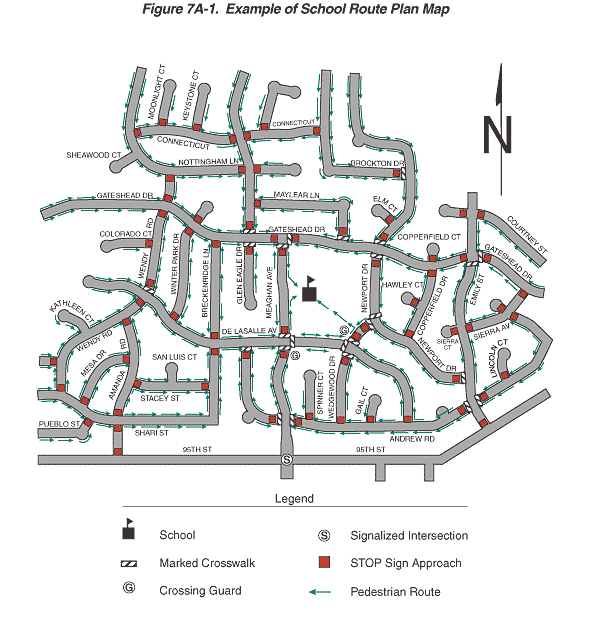
Figure 7A-1. Example of School Route Plan Map
This figure illustrates a school route plan map.
The figure shows an overhead view of a neighborhood map composed
of horizontal and vertical streets, traffic controls, pedestrian
routes, and a school. Each street is named, such as Gateshead Drive,
95th Street, and Meaghan Avenue.
A legend shows symbols for a school, marked crosswalk, crossing
guard, signalized intersection, stop sign approach, and pedestrian
route. A compass arrow points north.
The main street on the south side of the neighborhood is 95th Street,
which has the only signalized intersection. Other intersections
have one or more stop sign approaches. Marked crosswalks are shown
at many of the intersections, and two crosswalks near the school
show crossing guards. Green arrows show the pedestrian routes from
every street in the neighborhood to the school.
Back
to Chapter 7A
|