|
|
Why is ODOT planning this project? The OKC Boulevard is part of the original concept for the relocation and reconstruction of Interstate 40 in Oklahoma City. Improved safety and design standards on the new I-40 resulted in a reduction of exits serving downtown. The boulevard’s purpose is to reestablish access that was lost to downtown Oklahoma City. If the Boulevard was part of the I-40 project, why is ODOT looking at alternatives? The OKC Boulevard was approved in the environmental process for I-40 that was completed in 2002. Because of new developments in Oklahoma City in the last 12 years, ODOT and FHWA were asked to re-examine the alternatives for the Boulevard. This effort to re-evaluate design alternatives for the OKC Boulevard portion of the project is being conducted in an Environmental Assessment process to provide structure and assist in the evaluation and documentation of the decision making process. What Alternatives are being considered?
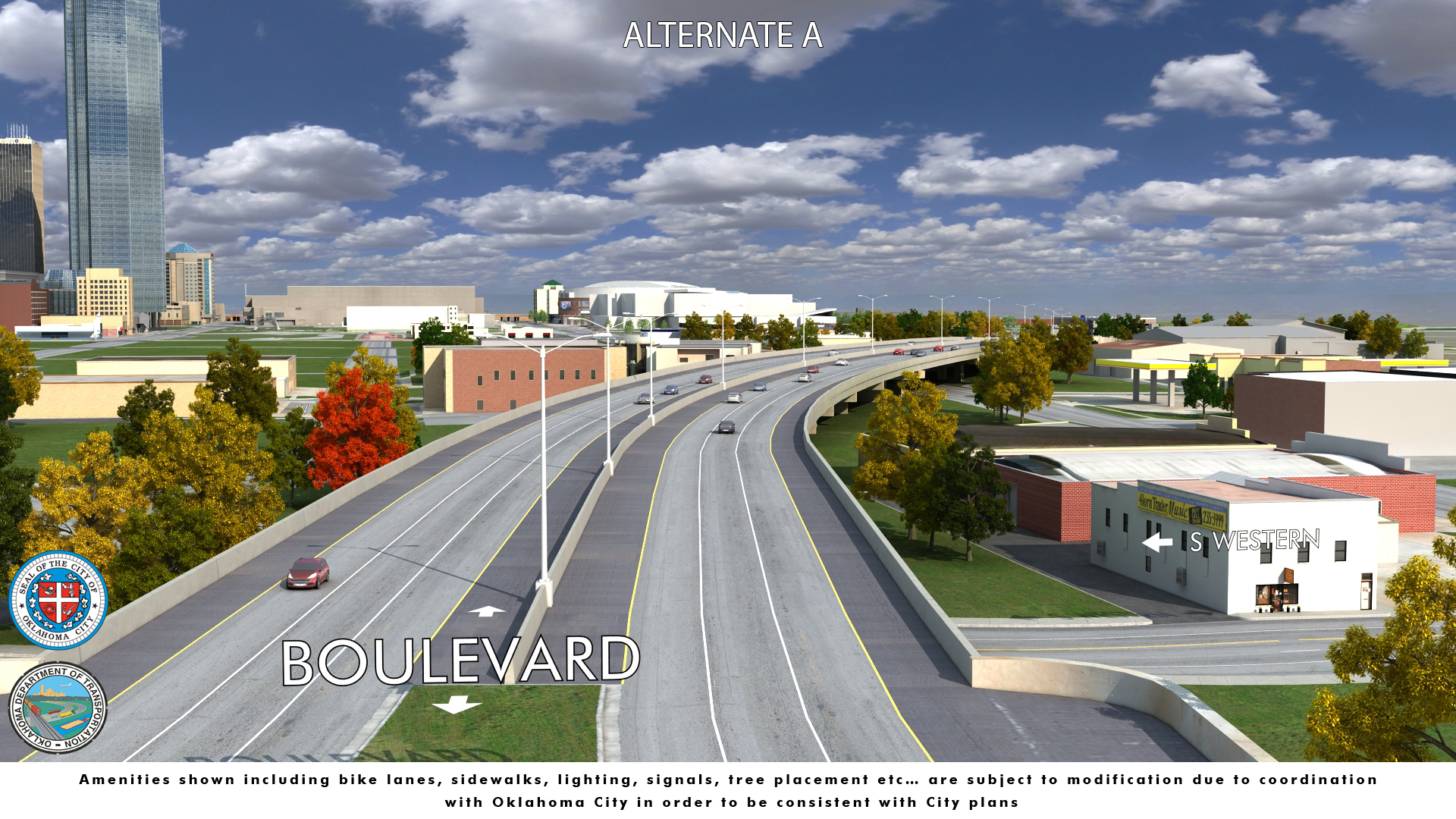
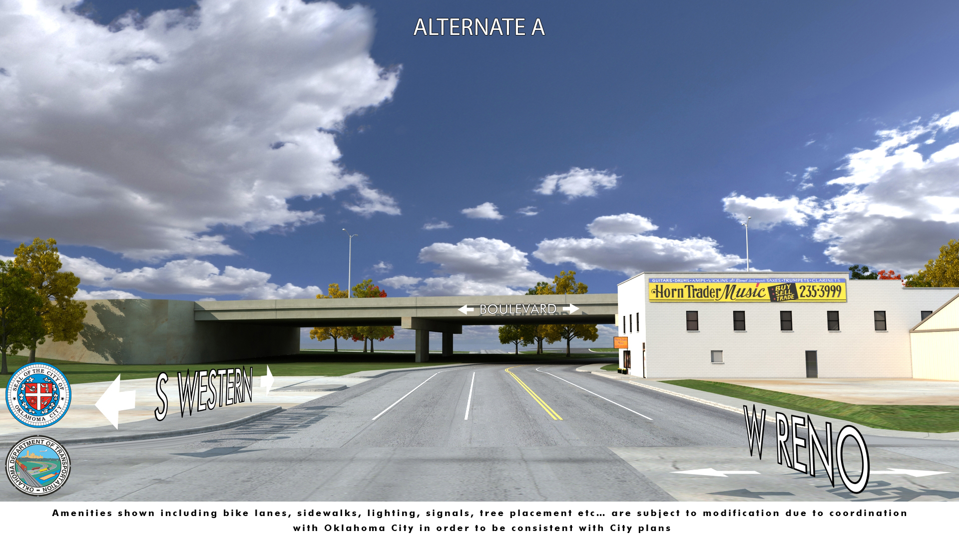
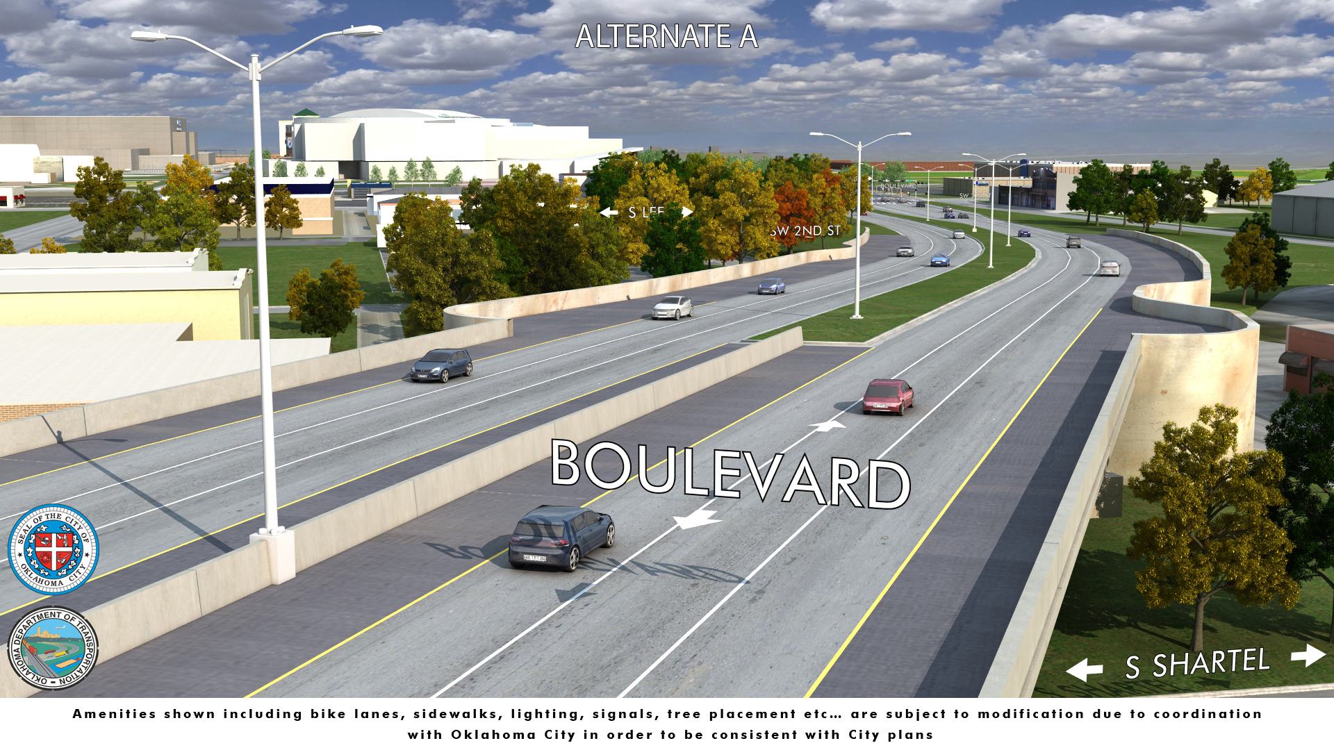
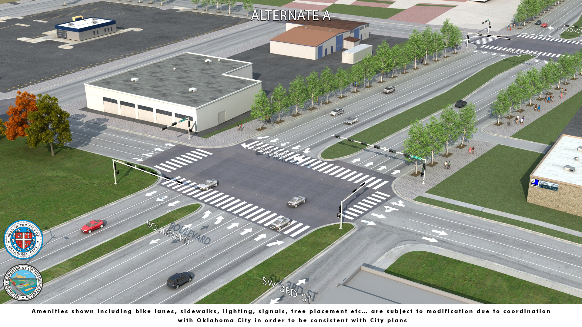
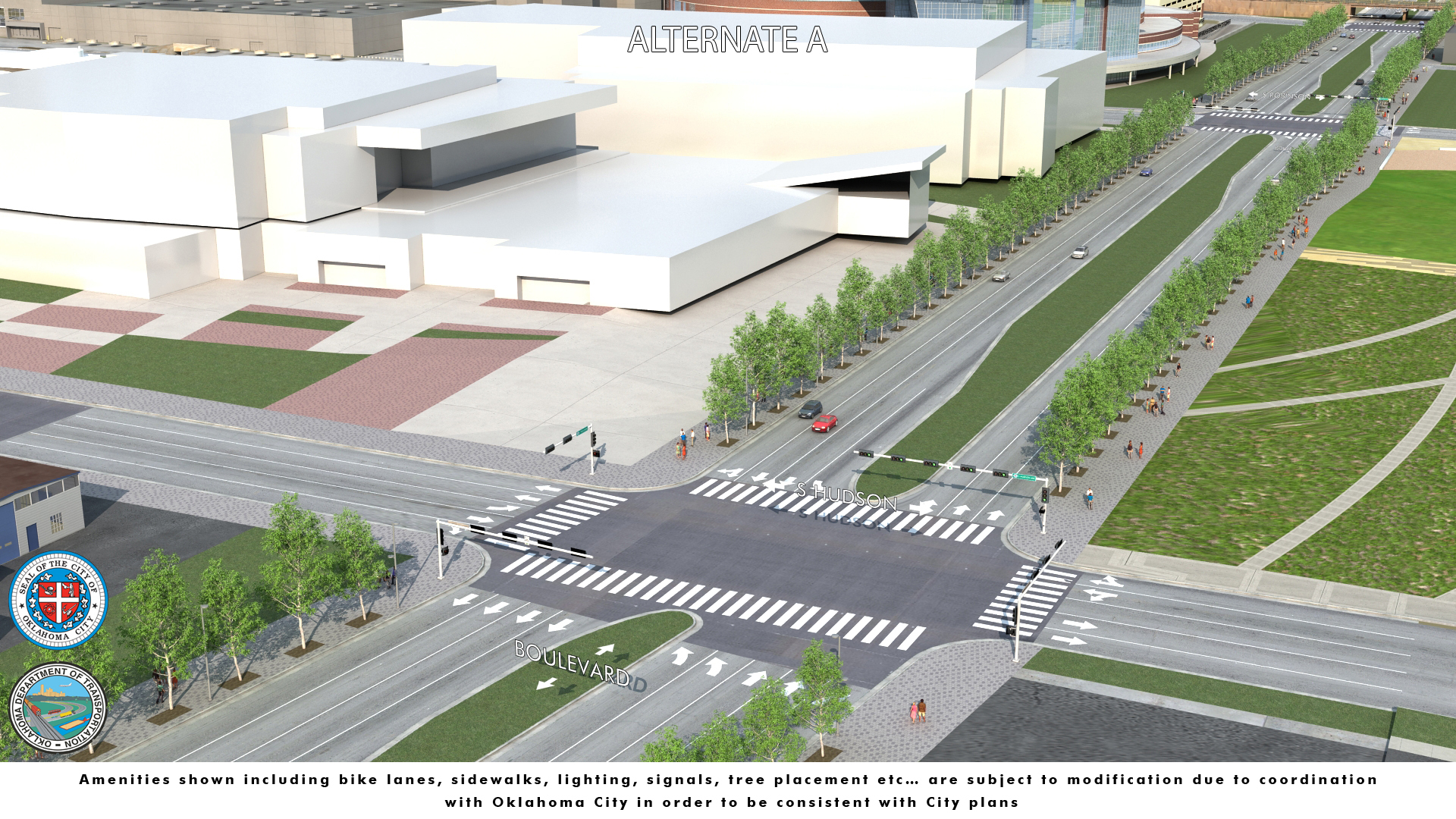
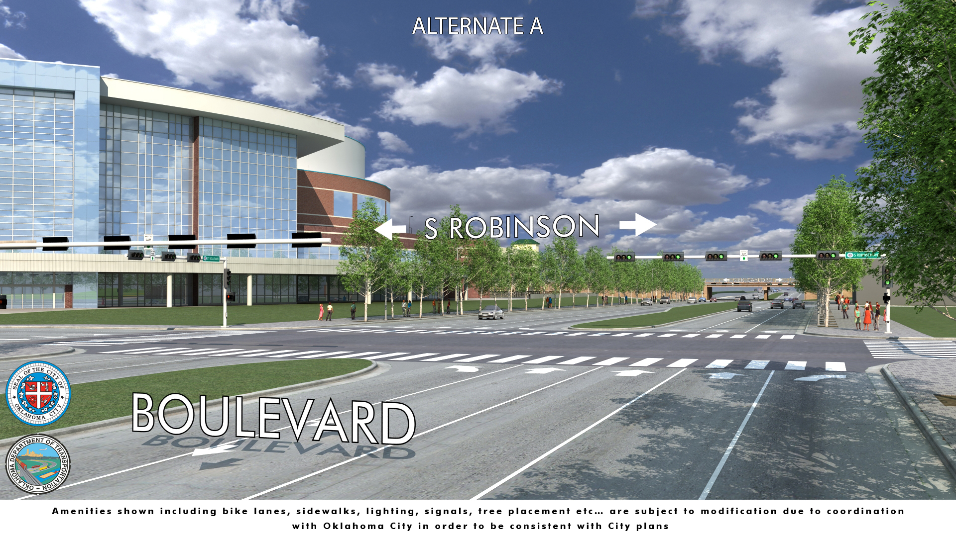
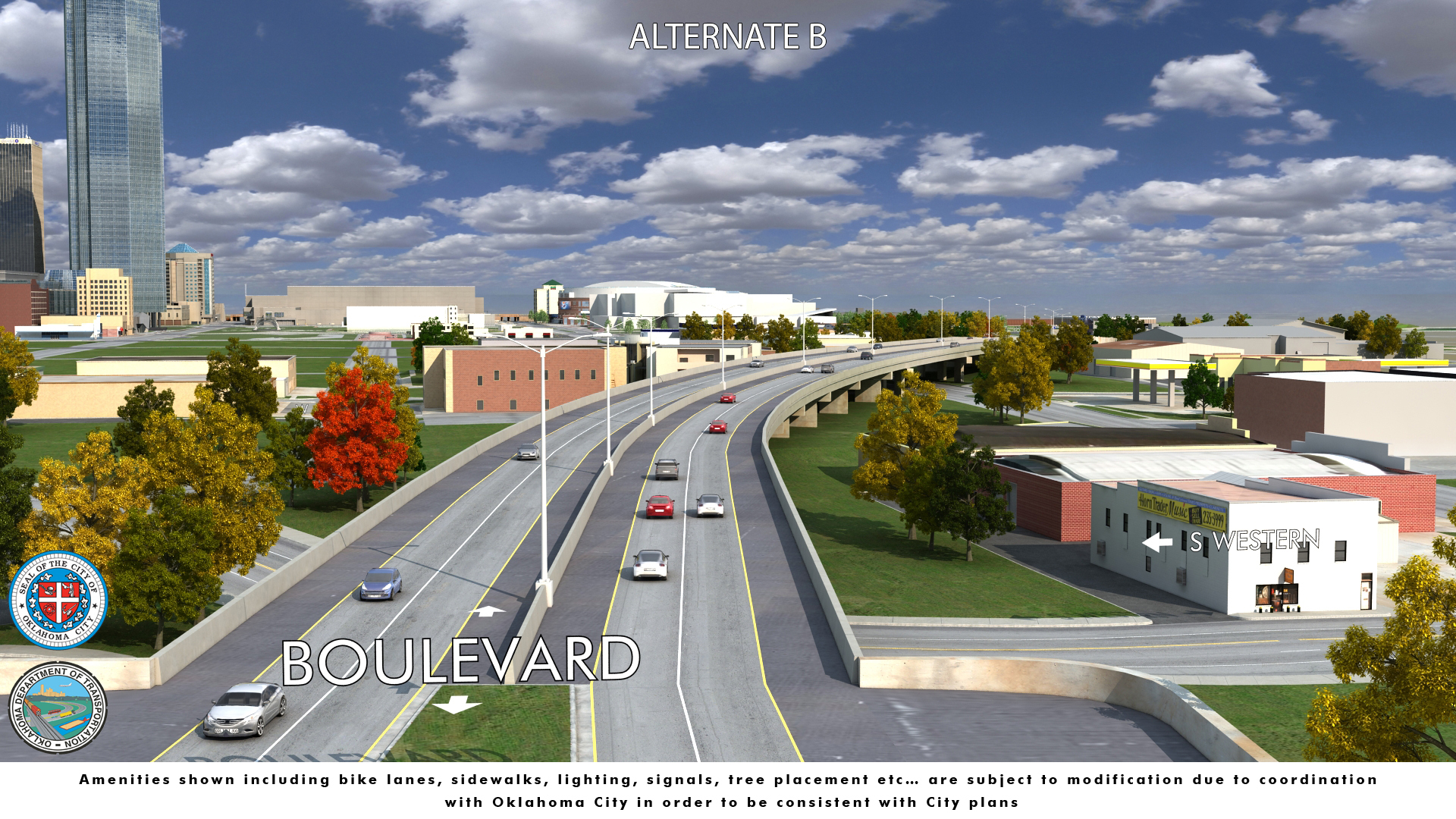
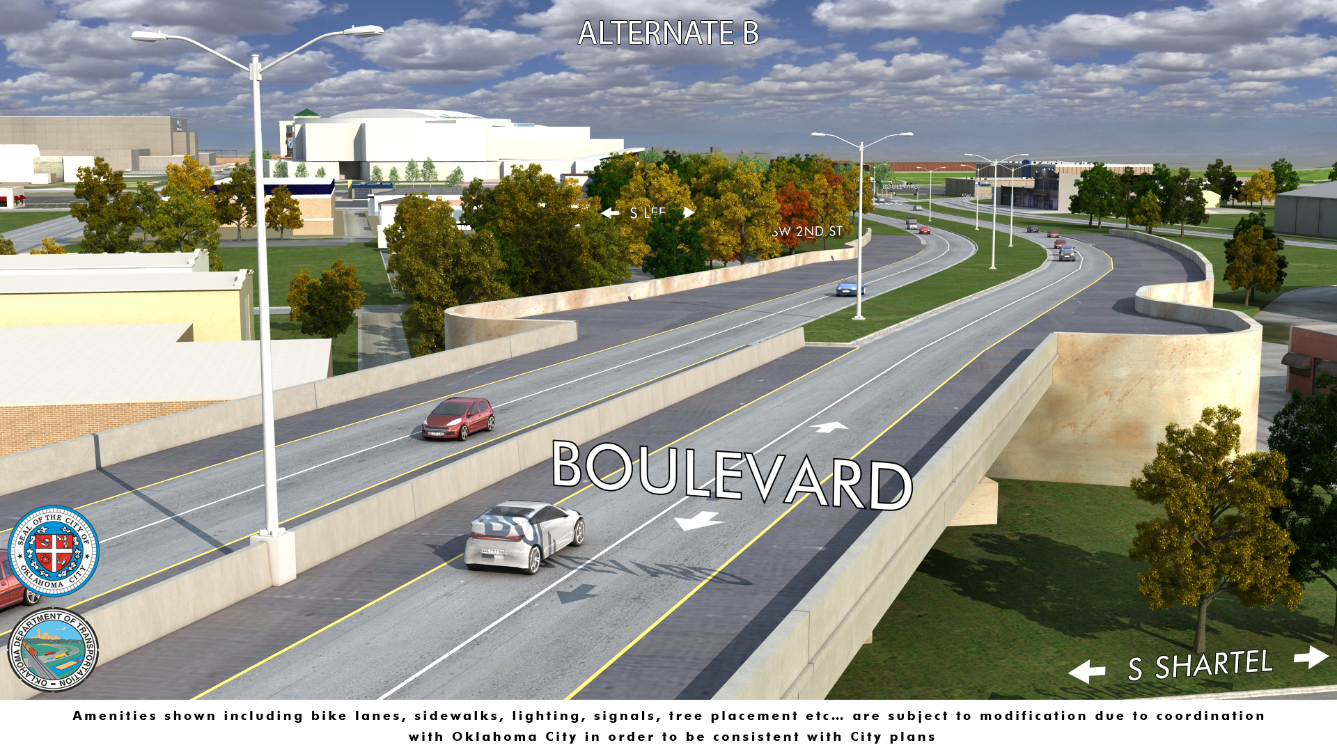
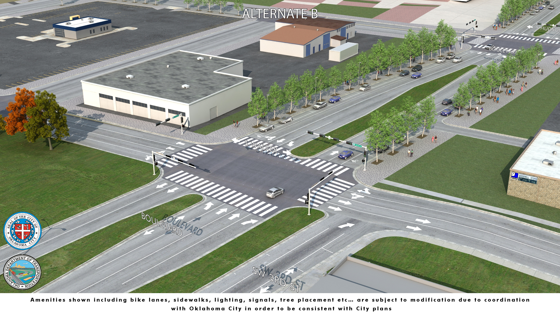
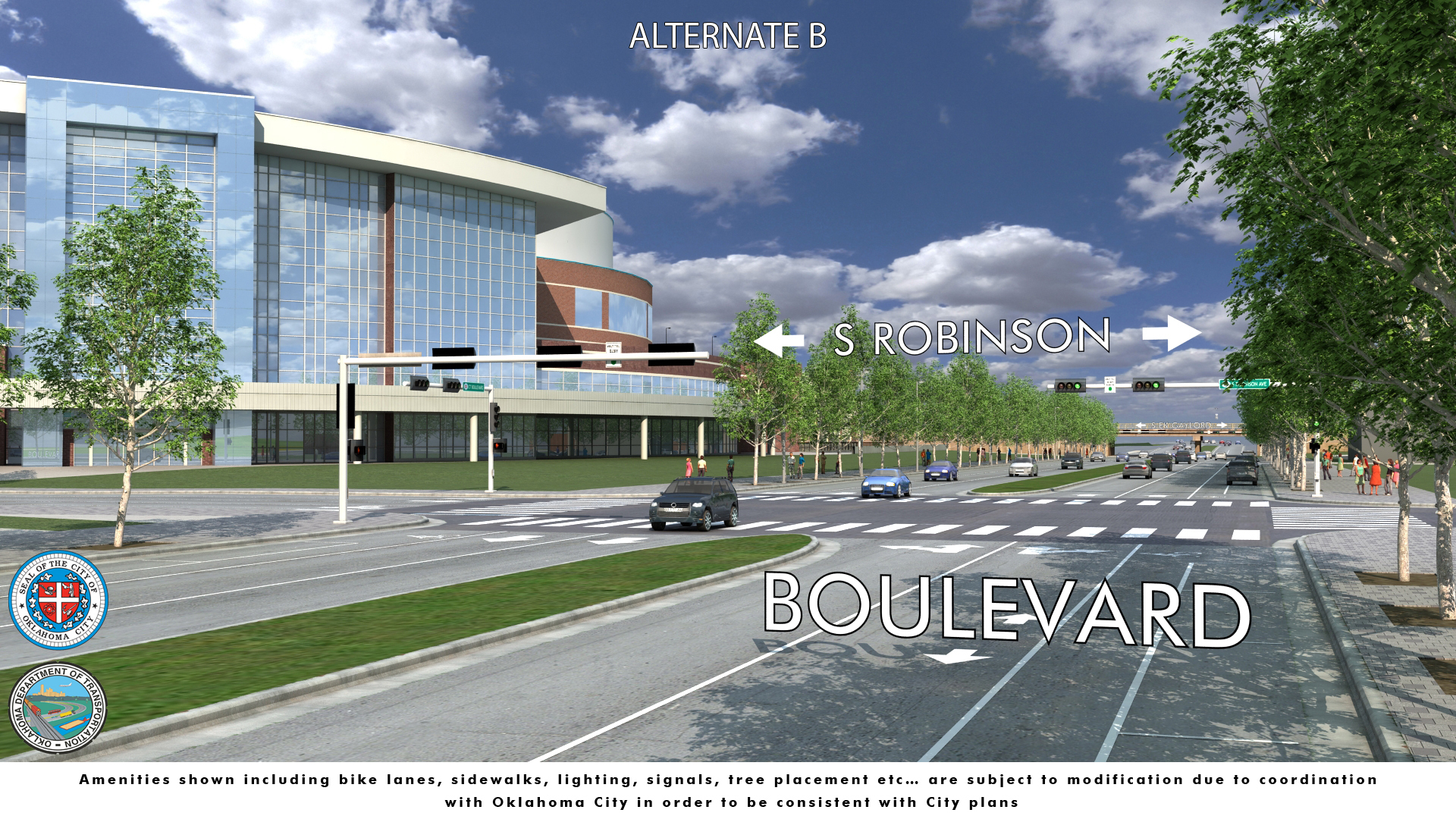
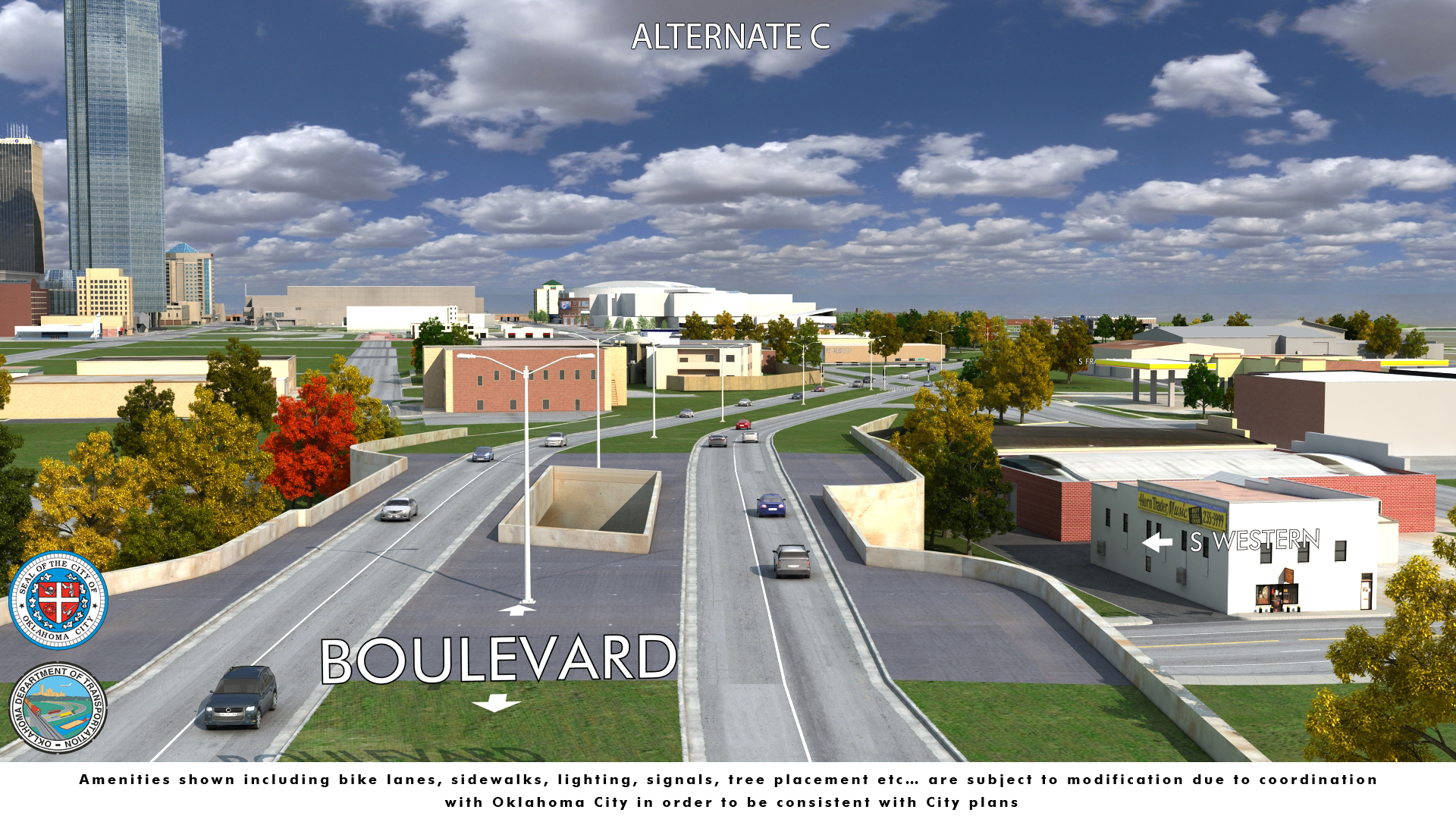
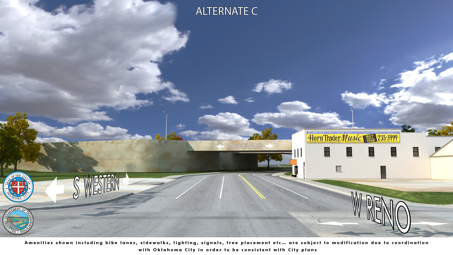
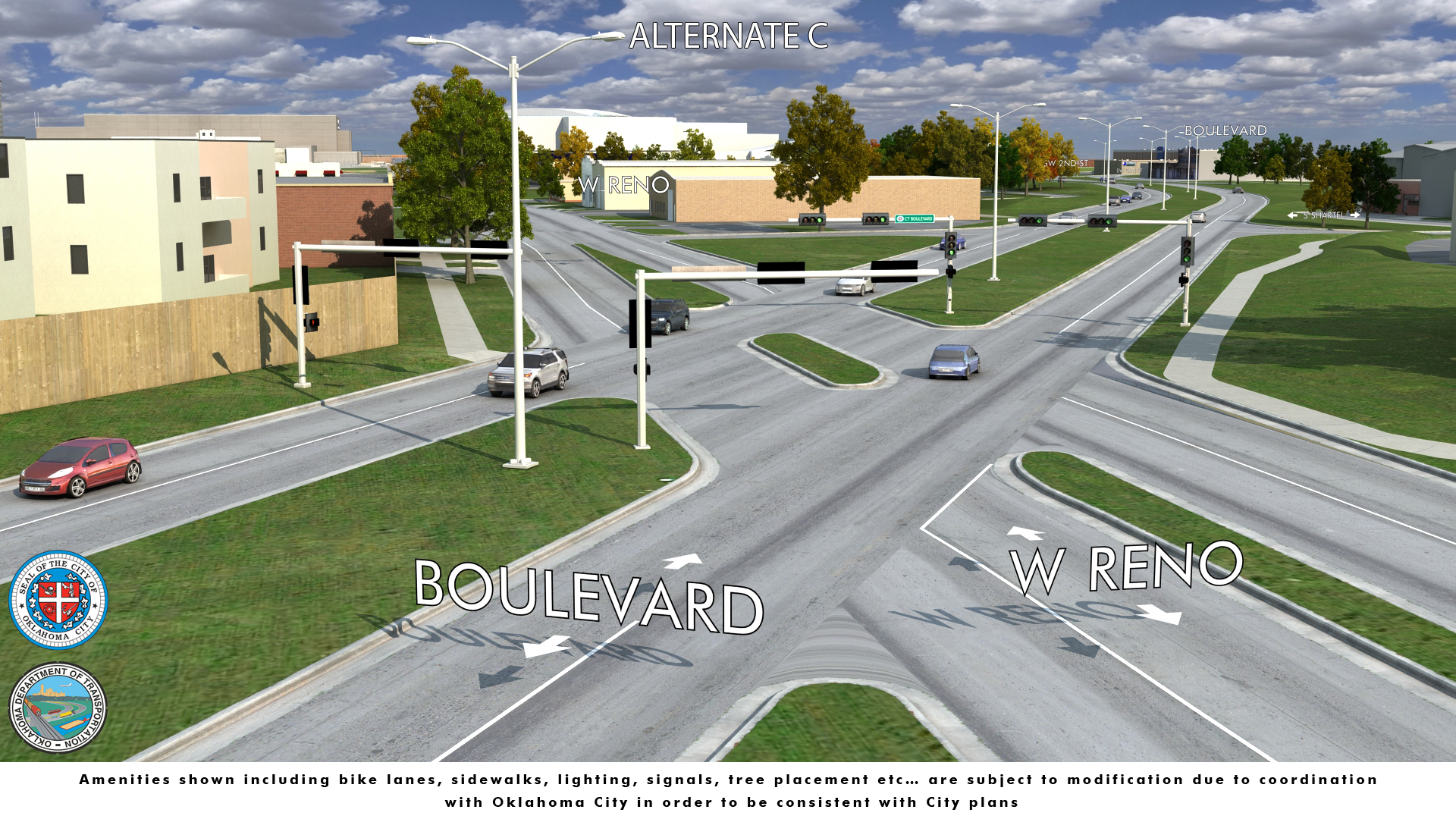
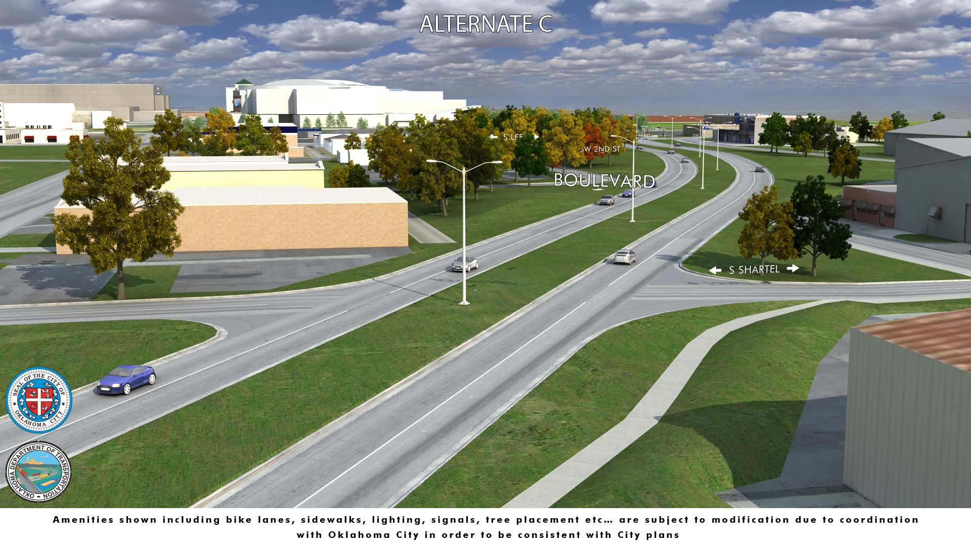
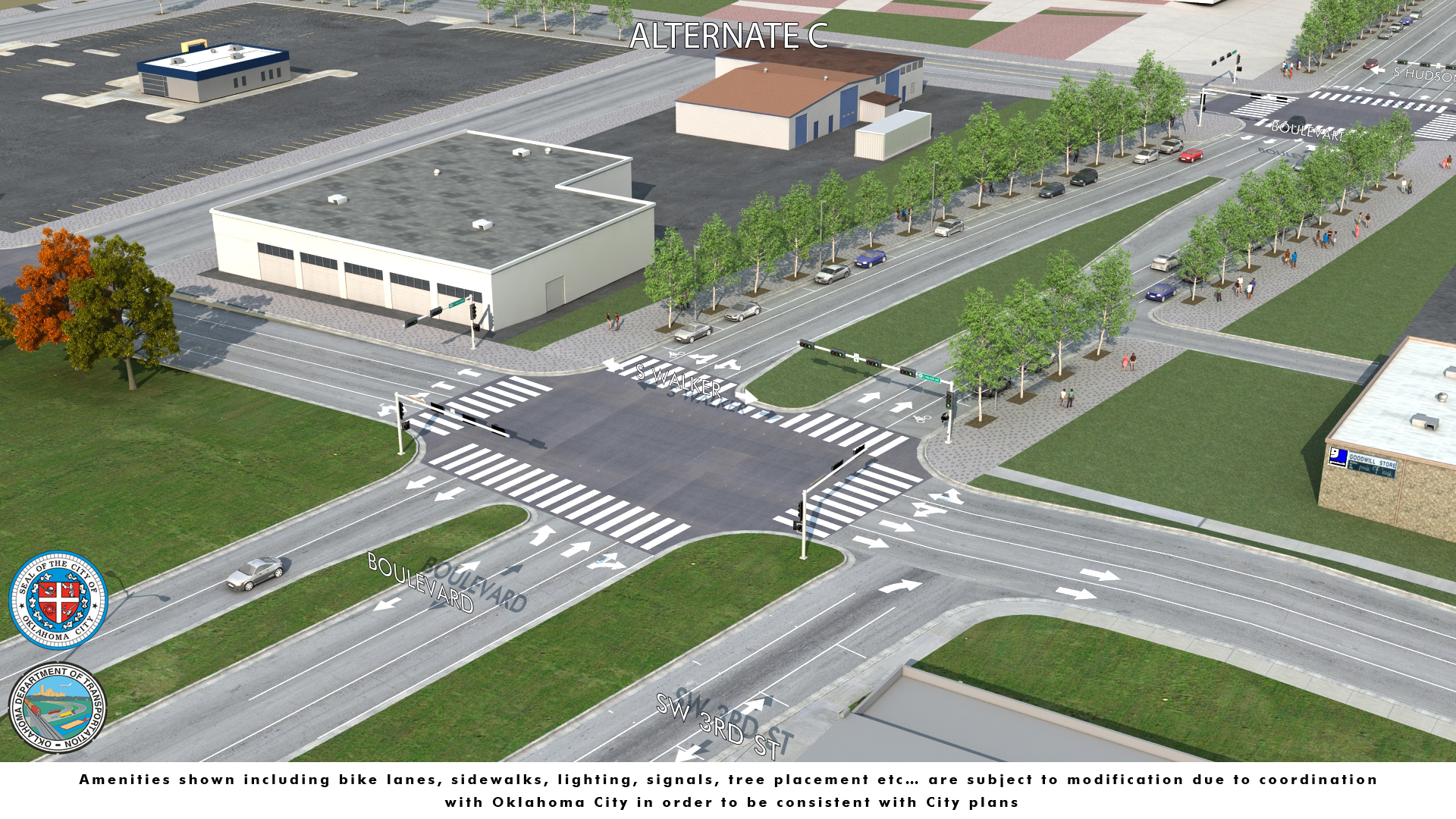
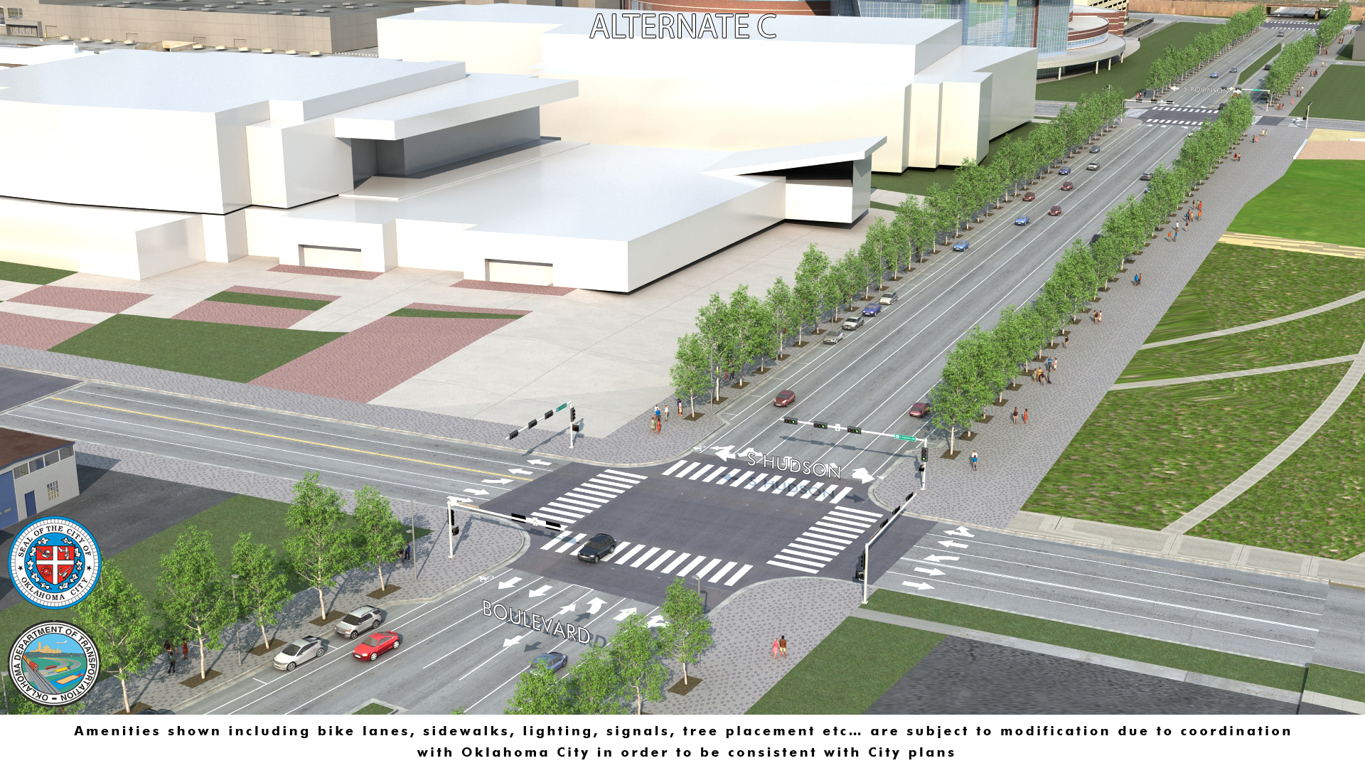
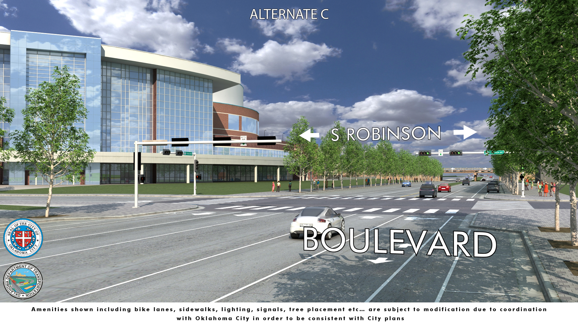
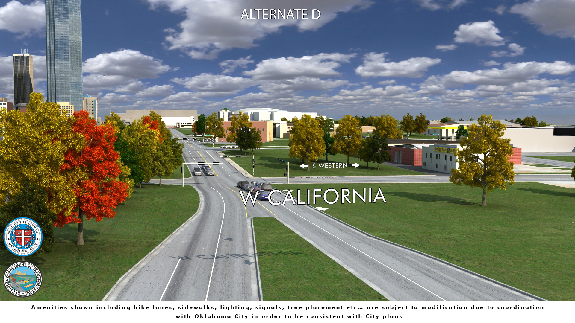
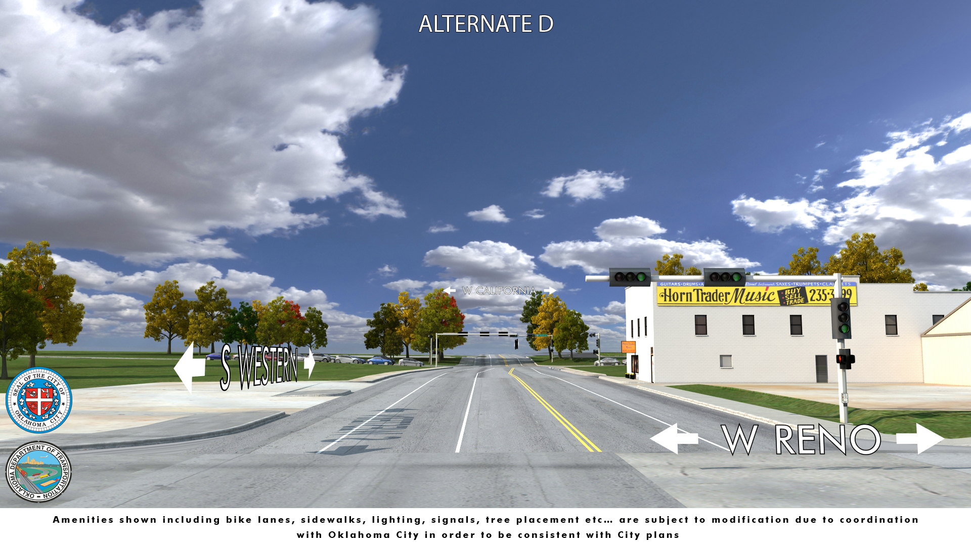
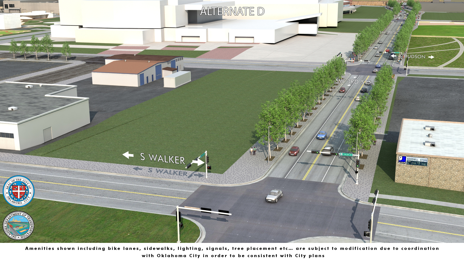
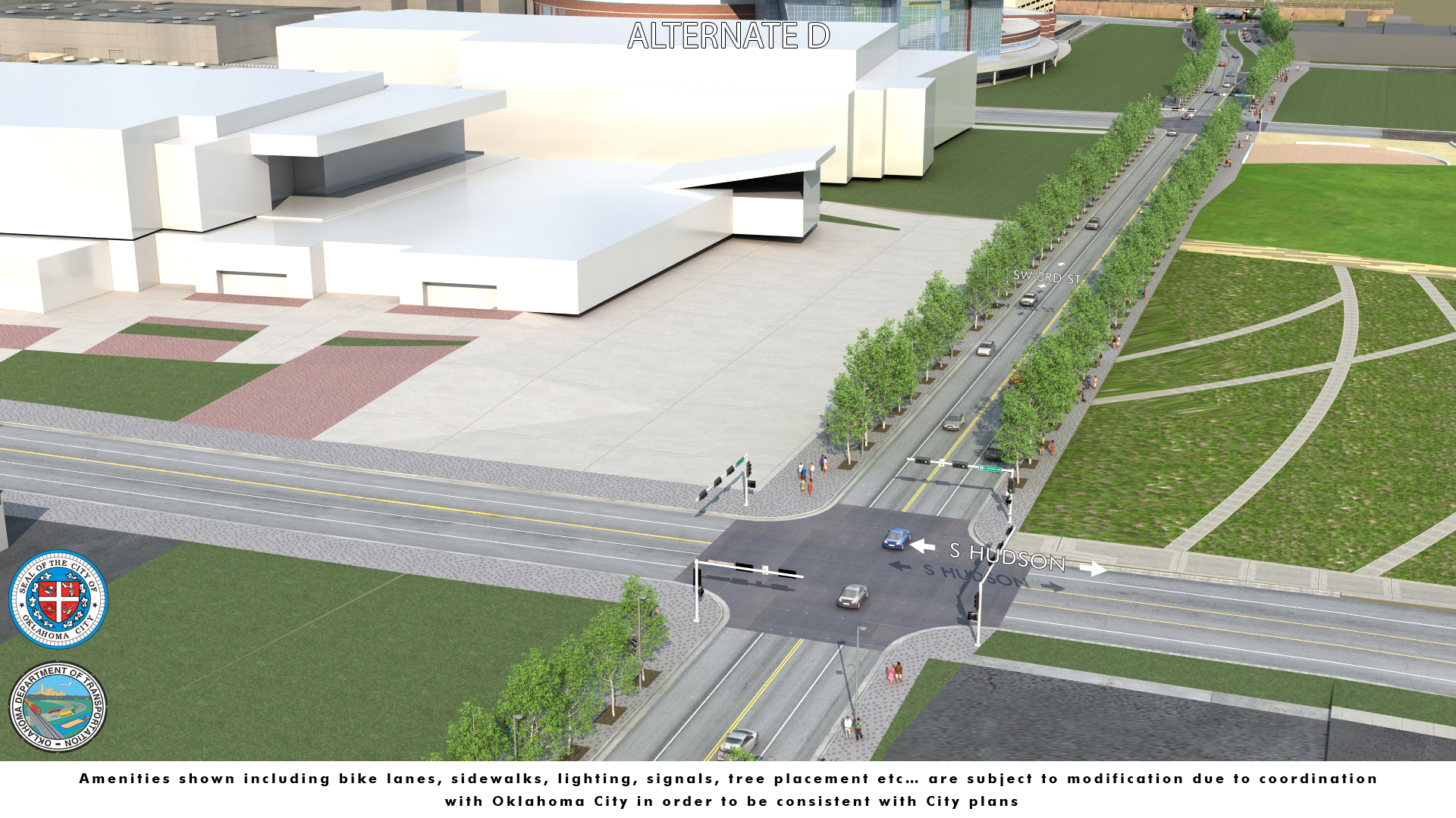
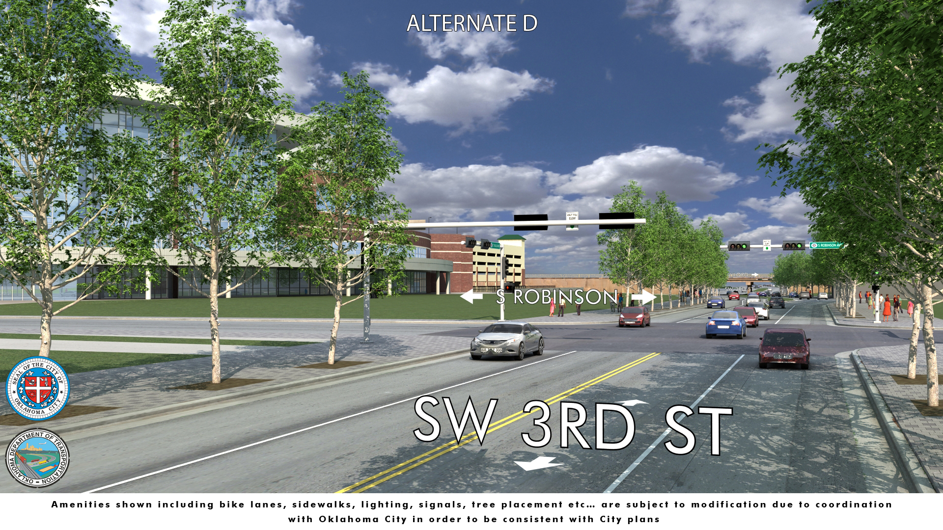
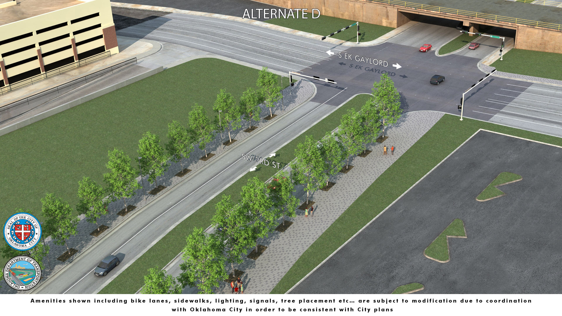
Will the Boulevard be an expressway? No. All the alternatives under consideration will operate as city streets, owned and operated by the City of Oklahoma City. Vehicle speeds will vary from near 65 mph at the I-40 off ramp near Agnew, to 45 mph west of Klein, to 25 mph through the Transition Section. Alternatives A, B, and C continue as a low-speed, 25 mph, urban street section through the convention and central park area, connecting on the east end through Bricktown, to the connection area for interstate access to I-235 and I-40. Alternate D includes the connection areas on each end, tying into the existing street network. No new streets would be constructed through the Core Section. Posted speed limits for Alternate D outside of the transitions will be the same as today. Why aren’t bike, pedestrian, and transit features shown on the alternatives at this point to help with a more informed body of public comments? Bike accommodations will be included in the preferred alternative, consistent with the most current Oklahoma City Bike Transportation Plan. Pedestrian and transit features like bus stops will be included in the preferred alternative selected by the environmental process, independent of which alternative is selected. The scale of the maps makes depicting all bike and pedestrian features difficult. Other visual tools are currently being developed to assist the public. Additionally, the Boulevard will be able to accommodate the planned Oklahoma City Streetcar should the route be expanded in the future. Will trucks be allowed on the Boulevard? Semi-truck and delivery truck access are important to commercial businesses, and would be expected to use public streets. The operation of the Boulevard will be subject to the City of Oklahoma City ordinances. What are the differences between the alternatives? Visual tools and artist renderings are being developed to assist the public. The following table may assist in explaining the major design features of each Alternate, by section. Please refer to public meeting graphics and additional information posted on the website. 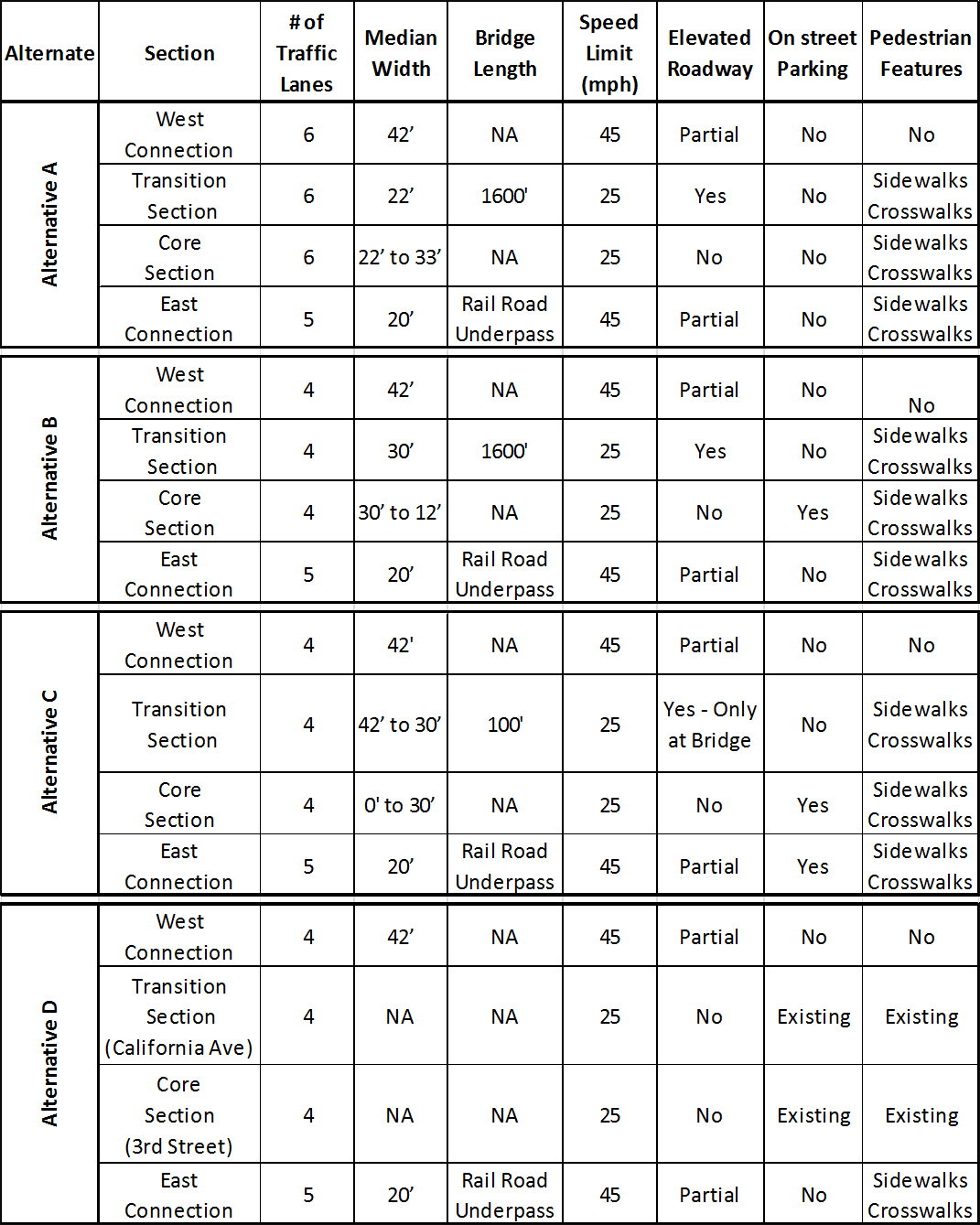 West Connection: From I-40 ramps near Pennsylvania east to Western Avenue Transition Section: From Western Avenue east to Walker Avenue Core Section: From Walker Avenue east to Shields/E.K. Gaylord Boulevard East Connection: Shields/E.K. Gaylord Boulevard east to I-40 ramps Why is ODOT suggesting changes to city streets like Classen and Exchange, and Lee and Shartel, shown as part of the alternates? The changes to city streets in the Transition Section were developed by the City of Oklahoma City with the assistance of independent consultants, considering traffic operations and land use forecasts. The consolidation of Western and Classen allows for improved traffic flow and a shorter bridge over Western Avenue on the Boulevard. An option to close Exchange Avenue was recommended due to a number of reasons. These include the safety concerns a large 5-leg approach intersection would have, the limited access it provides as a result of being one-way only, and the fact that affected businesses have access on the existing N-S or E-W city streets. At the City’s request, Alternate C was carried forward into the environmental process, along with these local street modifications. Alternates A and B also include these city street modifications. Specific comments concerned with restoring full intersection access at Shartel Avenue or Lee Avenue are also being considered and evaluated. What is the environmental process? The environmental process, or NEPA process, is the decision-making process that assesses the environmental impacts of a project and is required before federal funds are approved to be used for a project. It requires alternative courses of action be evaluated and decisions made in the best overall public interest based on the balanced consideration of the need for safe and efficient transportation, of the social, economic, and environmental effects of the proposed improvement, and environmental protection goals. The process involves coordination with the public and other agencies, as well as technical studies to inform the decision-makers. Who are the decision-makers? Transportation decision making for this project is a collaborative process which relies on cooperation between ODOT, the City of Oklahoma City, and Federal Highway Administration. Final approval of federal funds for this project resides with FHWA. Why do you ask for public comments so many times? The environmental process calls for early and continuing consultation with interested parties and others to advise and inform to achieve the following:
ODOT and FHWA use public comments to accomplish these goals. The next opportunity for public comment after June 13, 2014 will be during the Public Hearing period, anticipated by the end of the year. This occurs after the Environmental Assessment and all technical reports have been approved and made available to the public and interested agencies for review. What is the Boulevard’s potential effect to the historic Santa Fe Depot? While the Boulevard project will not affect the Santa Fe Depot itself, it has the potential to adversely affect the Santa Fe Depot Historic District by constructing an underpass through the concrete retaining wall that elevates the tracks. The historical documentation from the era, however, establishes the desire for an underpass at this location in the original plans. The underpass was later eliminated due to financial and engineering constraints, but is acknowledged in the final design approval from the Corporation Commission report that, “…it shall be expressly understood that the Santa Fe at any time in the future upon the demand of public authority or the City shall permit the opening of subways at Sixth Street and Noble Avenue (now 3rd Street), or either or both…”. The proposed use of the wall elevating the rail, is consistent with the intended use of the structure – to facilitate the movement of traffic in Oklahoma City. Constructing an underpass here for the Boulevard is consistent with the original design of the elevated rail. ODOT and FHWA are consulting with the Oklahoma State Historic Preservation Office regarding the potential affect. How will the boulevard project effect future rail use of the Santa Fe Depot? The design of the new Boulevard accommodates the possible future expansion of rail operations at the Santa Fe Depot by providing adequate clearance for the Boulevard under the existing and future railroad tracks. When will we see all of the final reports and documents? The environmental assessment and technical reports will be available, when approved by FHWA, anticipated to be later this year. The public hearing will be scheduled at that time. What is the timeline for the environmental process? Can the time to plan this important project be extended? The timeline for the environmental process varies based on the complexity of the project. The time required for this project depends on the time necessary to address public and agency comments, as well as time required to develop and complete technical reviews. The Public Hearing is anticipated later this year. How is my vote counted? The environmental process is not a voting process, but a process where projects are evaluated based on objective criteria and analyzed based on the social, economic, and environmental effects. Public comments are used to identify concerns that need to be evaluated and to help identify alternatives and measures which might mitigate adverse effects. How can I make my voice heard? Comments are accepted throughout the environmental process, however, in order to be fully considered in the technical review, comments should be submitted by June 13, 2014. Comments can be submitted by the following means:
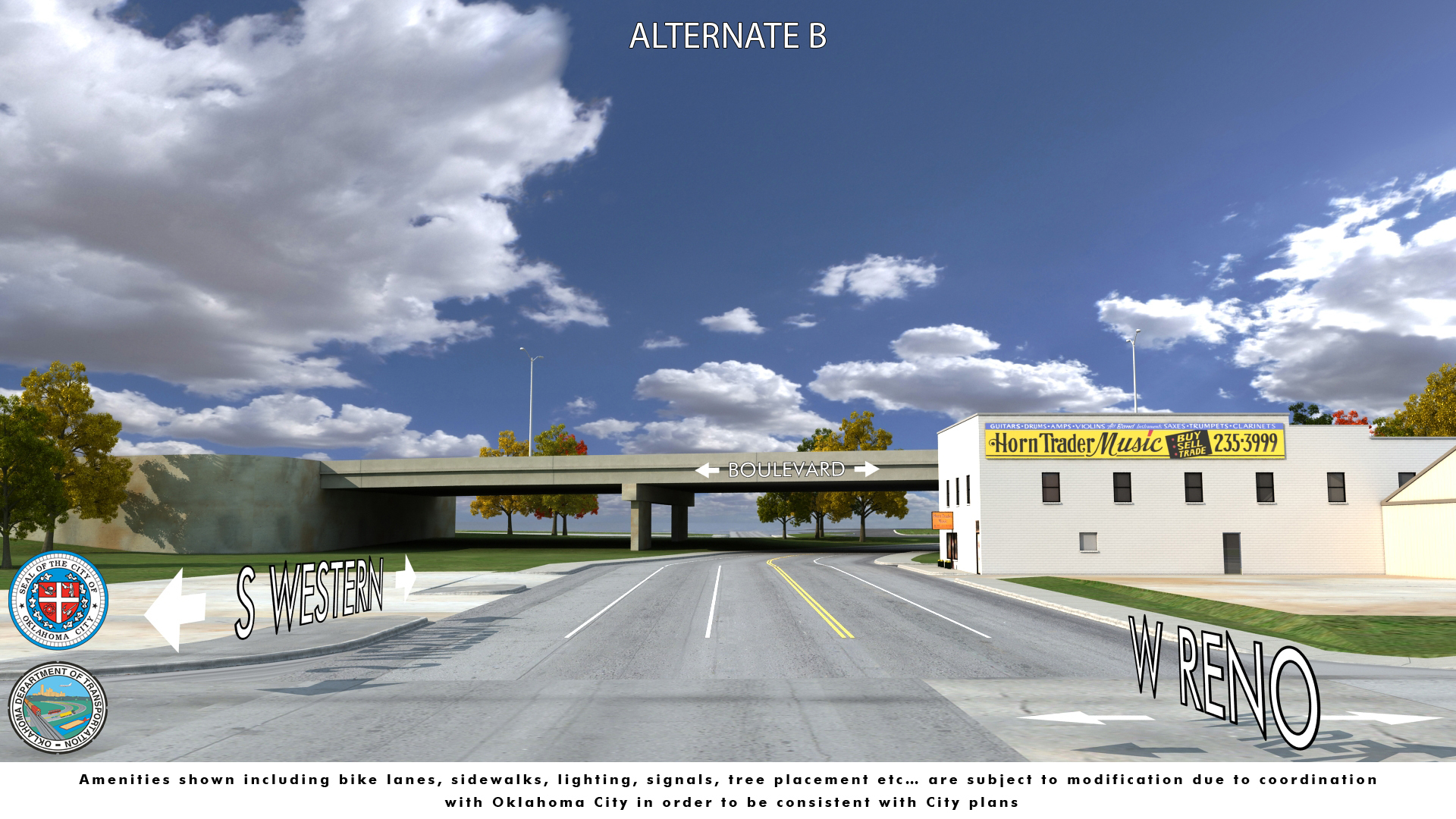
How much money is available for this project? There is $38 million programmed in ODOT’s current 8 Year Construction Work Plan for the remaining work on the OKC Boulevard. What happens after the environmental process is completed? When will construction start? Once a final decision is made and approved by FHWA, ODOT will have final design plans developed, and Oklahoma City will acquire any necessary right-of-way to construct the selected alternative. Any utilities in conflict with construction will need to be relocated, and only then can construction begin on the project. What are the criteria that were used in judging the alternatives? Criteria include how well each alternative meets the purpose and need for the project, and the social, economic and environmental effects of each alternative, as well as cost, traffic function both during and after construction, right-of-way impacts, constructability, and consistency with local planning. Does the City of Oklahoma City even want a Boulevard? The original concept of the Boulevard was developed in collaboration with the city, to address the city’s concerns with potential impacts of moving the interstate during the original I-40 project development process. ODOT and the City of Oklahoma City continue to be partners in the effort to restore critical access to the downtown area, consistent with all the city’s plans and vision for the area. Why is there so much elevated roadway on the west end? There are many reasons why the dirt fill and bridges cannot simply be removed and replaced with signalized intersections for the Boulevard. The reasons focus on safety and traffic needs. The design concept of the West Connection area is controlled by both design standards like maximum vertical grades, and required clearances over railroads and streets, safety requirements like stopping sight distance (how far it takes for a vehicle to slow or stop to avoid a collision with a stopped, turning or crossing vehicle), and intersection proximity (intersections need to be far enough apart that cars and trucks can maneuver and clear the intersection safely). Design standards require the exit and entrance ramps from Interstate 40 to the Crosstown Boulevard be over the railroad on the east end of ramps. The distance between the railroad and Pennsylvania Avenue is too small to safely achieve a signalized intersection at Pennsylvania and the new Boulevard. The grade would be too steep, and not enough distance would be available to stop at the intersection. Also, a signalized intersection at Pennsylvania or Virginia Avenue and the boulevard would result in cars and trucks being held at the light for crossing traffic, queuing and backing up stopped traffic onto the ramp and interstate, a very dangerous situation. Pennsylvania is an important north-south arterial street and cannot be blocked, so the Boulevard must go over Pennsylvania on a bridge, which is called “grade separated”. Local access to the West Connection is important, in order to serve the existing industrial and commercial properties in the area. Since access cannot be provided safely by a signalized intersection as explained, a bridge over Virginia Avenue and on and off ramps to and from the Boulevard are the only option to keep traffic safely operating on both Virginia and the Boulevard simultaneously. Indiana Avenue is the next north-south street crossing with the Crosstown Boulevard. The eastbound Boulevard ramp from Virginia, and the westbound off ramp to Virginia creates a weaving conflict point where an intersection would be placed, creating unacceptable safety concerns, due to the likelihood of rear-end and side-swipe collisions. To preserve existing north-south traffic uninterrupted on Indiana, the Boulevard must go over Indiana on a bridge. Blackwelder is the next north-south city street. Its proximity to a bridge over Indiana Avenue make a signalized intersection unsafe because the vertical grade required to get to street level at Blackwelder causes inadequate stopping site distance. To preserve existing north-south traffic uninterrupted on Blackwelder, the Boulevard must go over Blackwelder on a bridge. East of Blackwelder, the land use is generally large tract industrial, and none of the city streets provide more than local access between Sheridan and Reno. When Interstate 40 was located in the corridor, local traffic in the area was served by access at Klein Avenue. Due to local land uses and existing traffic, adding a signalized intersection is not warranted at this time, but access is provided to and from the Crosstown Boulevard by right-turn only access at Klein Avenue. If, in the future, the City of Oklahoma City determines that the needs of the area require additional access to the Boulevard, it can easily be modified. What are the traffic models being used to evaluate the traffic? When were the counts taken? Is it the most current information? The traffic study utilizes two standard traffic engineering methodologies to conduct intersection capacity analyses. For signalized intersections, Synchro Professional, Version 7.0, which is a software package for modeling and optimizing traffic signal timings at signalized intersections was used. For unsignalized intersections, the methodology from the 2010 (5th) edition of the Highway Capacity Manual (Transportation Research Board, 2010) was used. The original study performed traffic counts in late 2004 and incorporated a 2% growth factor to the forecasted year of 2030. Based on the recent reduction in growth rates in vehicle miles travelled both nationally and regionally, the projected traffic for the area of boulevard for 2040 is forecasted using an approximate growth factor of 1.25%. Since the original traffic study was conducted, the City of Oklahoma City has constructed portions of the Downtown Streetscape Project 180. The study also reviewed the traffic distribution so the volumes account for known future developments and land uses in the area. This includes information regarding land uses and developments such as the new convention center, new hotels, high-density residential and additional commercial and retail developments. Based on the information provided, traffic distribution along the Boulevard reasonably reflects the anticipated area developments and land uses. What alternatives are eligible for federal funding? Any alternate that is evaluated in the Environmental Assessment (EA) and selected as the preferred alternative will be eligible for federal funding provided the EA results in a Finding of No Significant Impact, or FONSI by Federal Highway Administration. Federal funds are allocated to ODOT directly, and to cities like Oklahoma City through Metropolitan Planning Organizations, like ACOG, the Association of Central Oklahoma Governments. Funding availability is subject to state and local matching funds requirements, other federal planning requirements, and agency budgetary constraints. How will the selected alternative be funded? The current agreement between the City and ODOT specifies that ODOT will allocate federal funds towards the Boulevard construction within the former right-of-way for I-40. As all alternatives under consideration include work outside the former right-of-way, it is anticipated that the project agreement will be amended after the completion of the environmental process. Funding sources and commitment of funds by ODOT and Oklahoma City will be determined at that time. Back to Top
|